ANSIS use case: Soil state and trend assessment
Use cases are examples that show the potential benefits of the Australian National Soil Information System (ANSIS) by practically demonstrating the value of ANSIS. The use cases show how ANSIS could support a range of users making decisions regarding the sustainable management of Australia’s valued soil resources into the future.
Soil data for natural resource management
Soil is one of our most valuable natural assets. It regulates climate, grows our food and fibre, supports infrastructure, and underpins biodiversity and natural habitat. Land use and management influence the state of our soil, and its ability to support different ecosystems may change. Understanding the extent and trend of this change helps guide future management decisions to protect and improve our soil.
How ANSIS could support soil state and trend assessments
Understanding the impact of changes to soil properties over time requires an assessment framework and consistent, harmonised historic and current soil data. This use case developed an assessment framework that: describes the impact of soil change on the potential delivery of multiple ecosystem services; identifies key soil functions and measures; defines how measurements are given a condition score for different services; and suggests how these condition scores can be aggregated to provide a wholistic condition assessment across multiple ecosystem services.
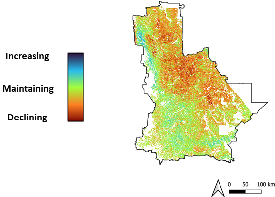
An example map output showing where soil condition is maintaining, increasing or declining. Note that use cases are examples of potential use only.
In this use case ANSIS enabled access to multiple sources of soil data, ensuring the best available and most up to date information was used to model the state and trend of soil properties across Australia. A trend assessment was then undertaken at a regional level to understand soil changes, identifying which soils were declining, maintaining, or improving condition for different agricultural land uses, and which assessed soil properties were of most concern.
How the soil information product could be used
State and trend assessments could be used to support Natural Resource Management groups to identify key degradation issues and prioritise areas for management and investment.
This is just one example of how ANSIS could support the development of soil information products at regional levels. Other examples may include assessment of soil to assist with the development of policy and programs at local, regional and national levels, for investment prioritisation by financial institutions, regional and national reporting such as State of the Environment, natural capital accounting, and input to ecosystem condition maps.
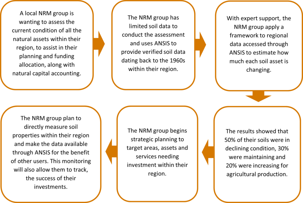
Supporting assessment of soil change: Example narrative